
3D Outdoor Concrete Topography Map
Interactive Watershed Educational Display
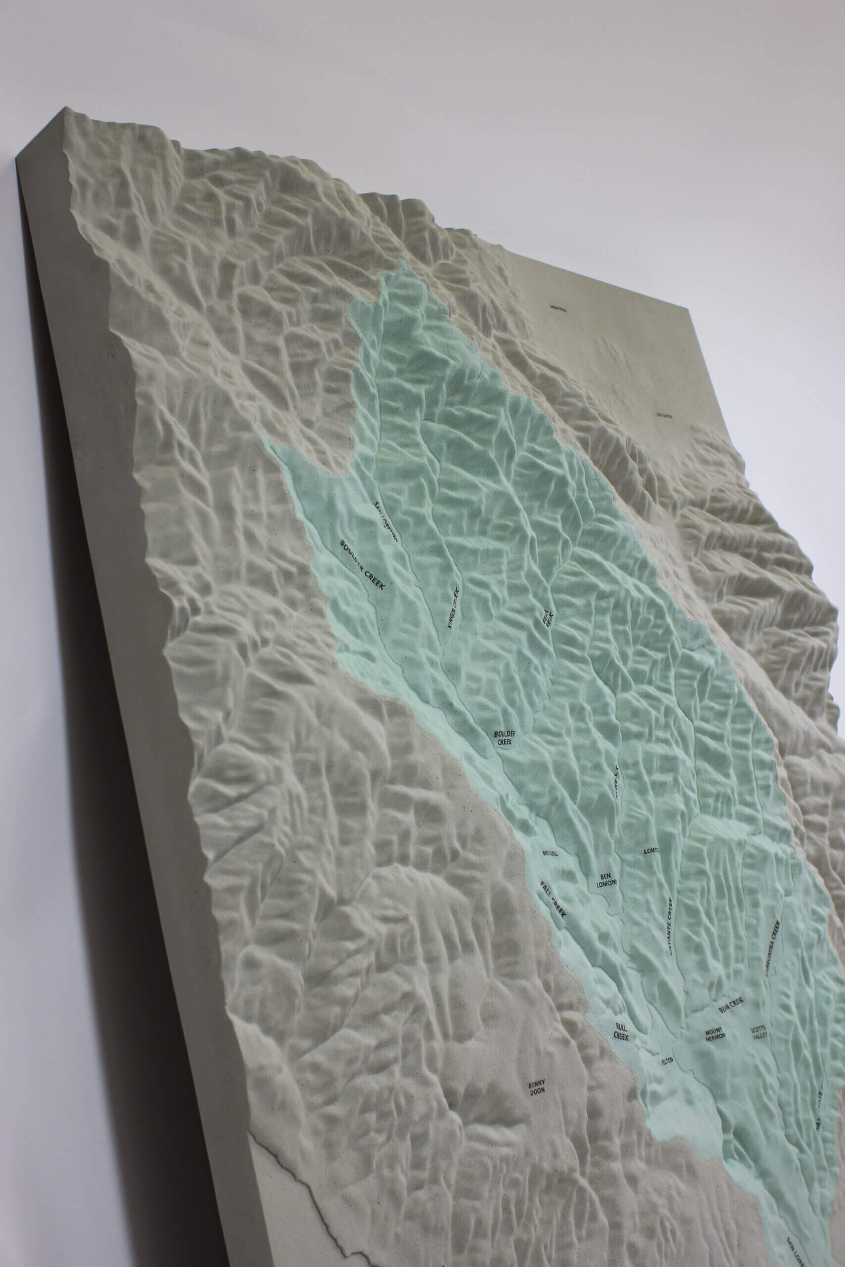
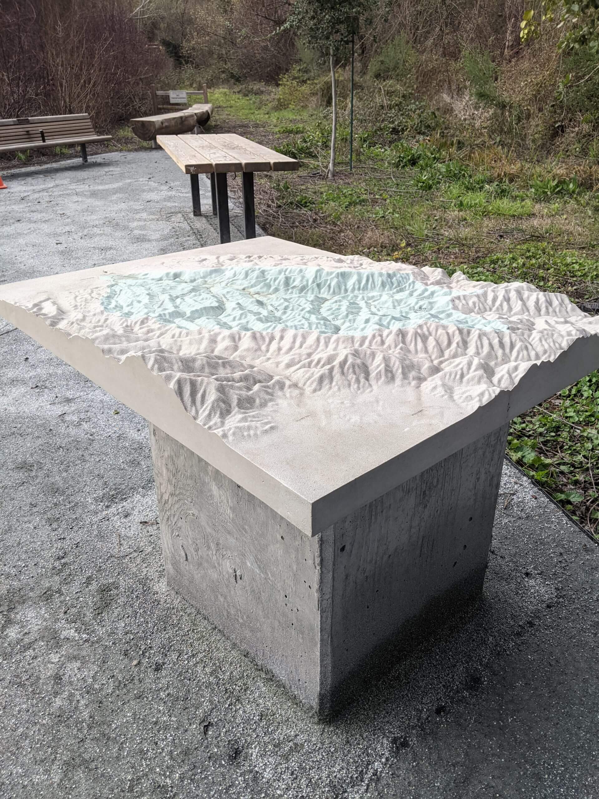
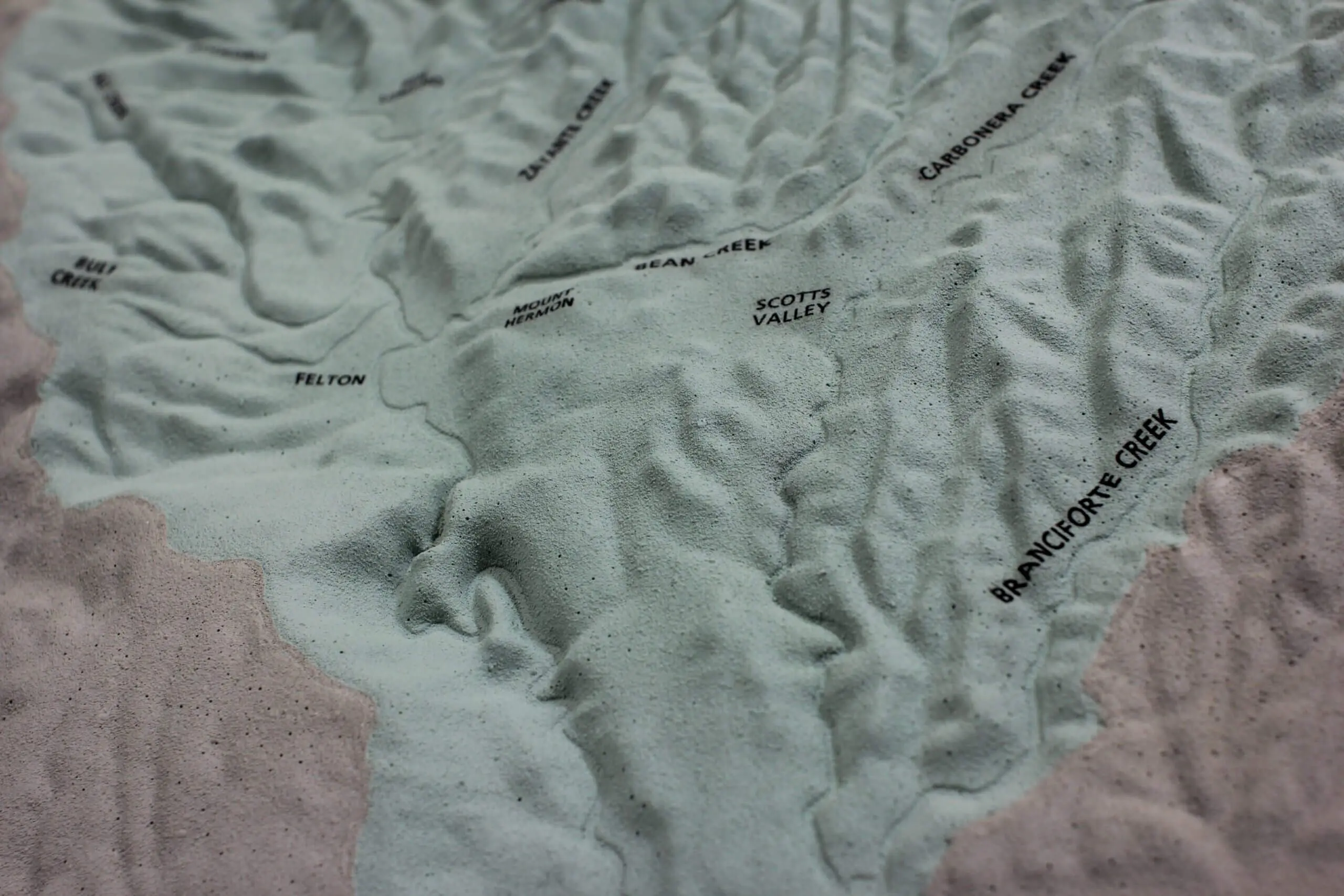
Felton Library Discovery Park features a section focused on local watershed activity to educate its audience on the importance of water in the Santa Cruz Area. The landscape architect specified that a 3D map be built that visualized how water flows throughout the community. Participants would engage with the San Lorenzo 3D Watershed Map by pouring water directly onto its surface, then watch as the water flows towards the ocean. The landscape architect’s design also specified that this interactive map be displayed outside, uncovered, and in direct sun so the material needed to be resilient.
The biggest challenge was developing a product that was more cost effective than bronze, but still offered excellent weather and UV resistance. Concrete was an obvious material choice, but weight was a concern. By implementing a process developed by Kreysler & Associates, LGM was able to meet the client’s needs. This concrete watershed map is lightweight, easy to install, and structurally rigid. LGM developed the 3D digital elevation model from GIS and satellite imagery, partnered with Kreysler & Associates for production, and finished the map with embedded text markers. The final product is a water and UV resistant concrete watershed relief map.
“The map is getting installed today! Thanks so much.” – Will Fourt | Park Planner, County of Santa Cruz
Client: County of Santa Cruz Parks, Open Space and Cultural Services; BASE Landscape
Duration: 18 Weeks
Cost Estimate: $ 18000 – 25000
Size: 36x48x5″
Scale: 1″=2640′
Inputs: GIS Data, Satellite Imagery, Watershed Maps
Equipment & Processes: CNC Mill, Hand Built Assemblies, Painted Finish, Concrete + Fiberglass Reinforced Polymer
Tour the Park: Felton Library Discovery Park
In the News: Felton Library Discovery Park | Felton, USA | BASE Landscape Architecture (World Landscape Architect)