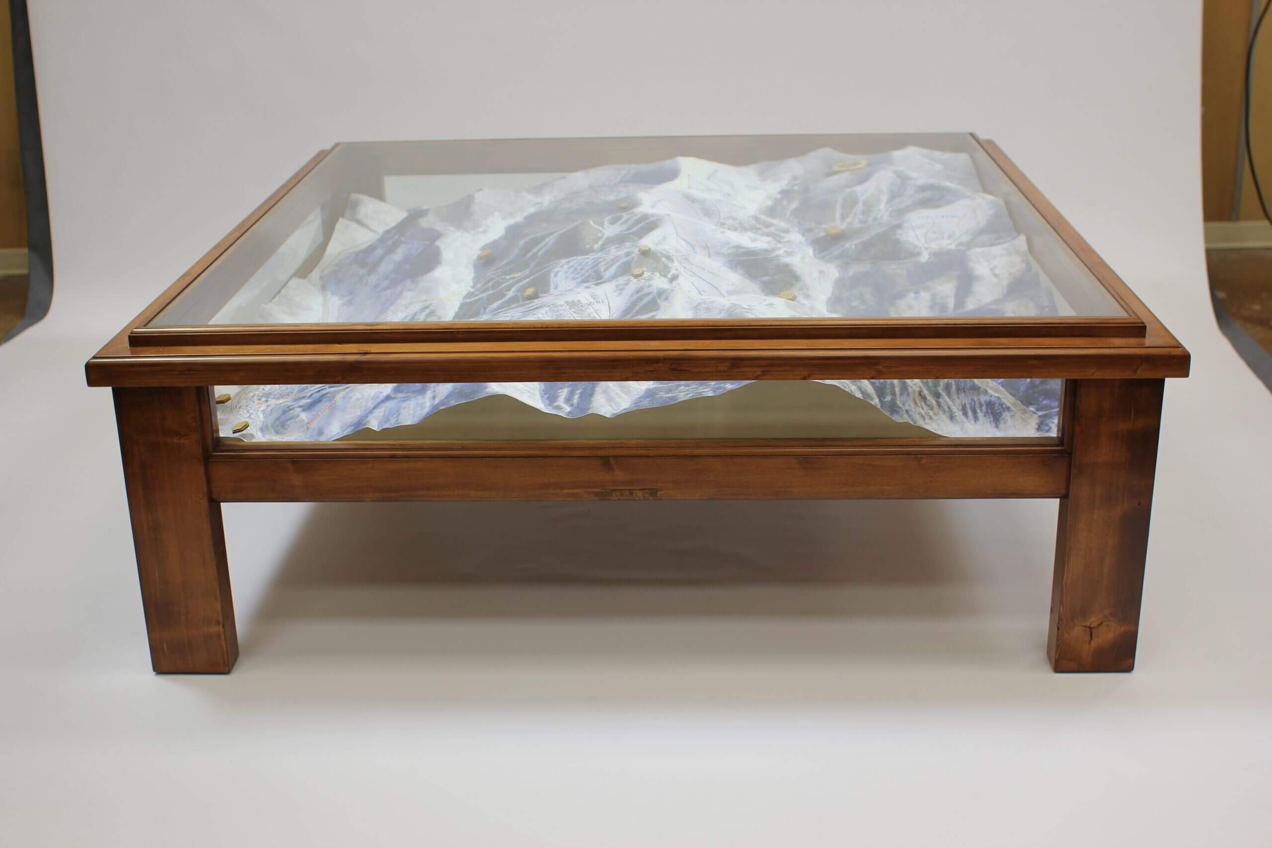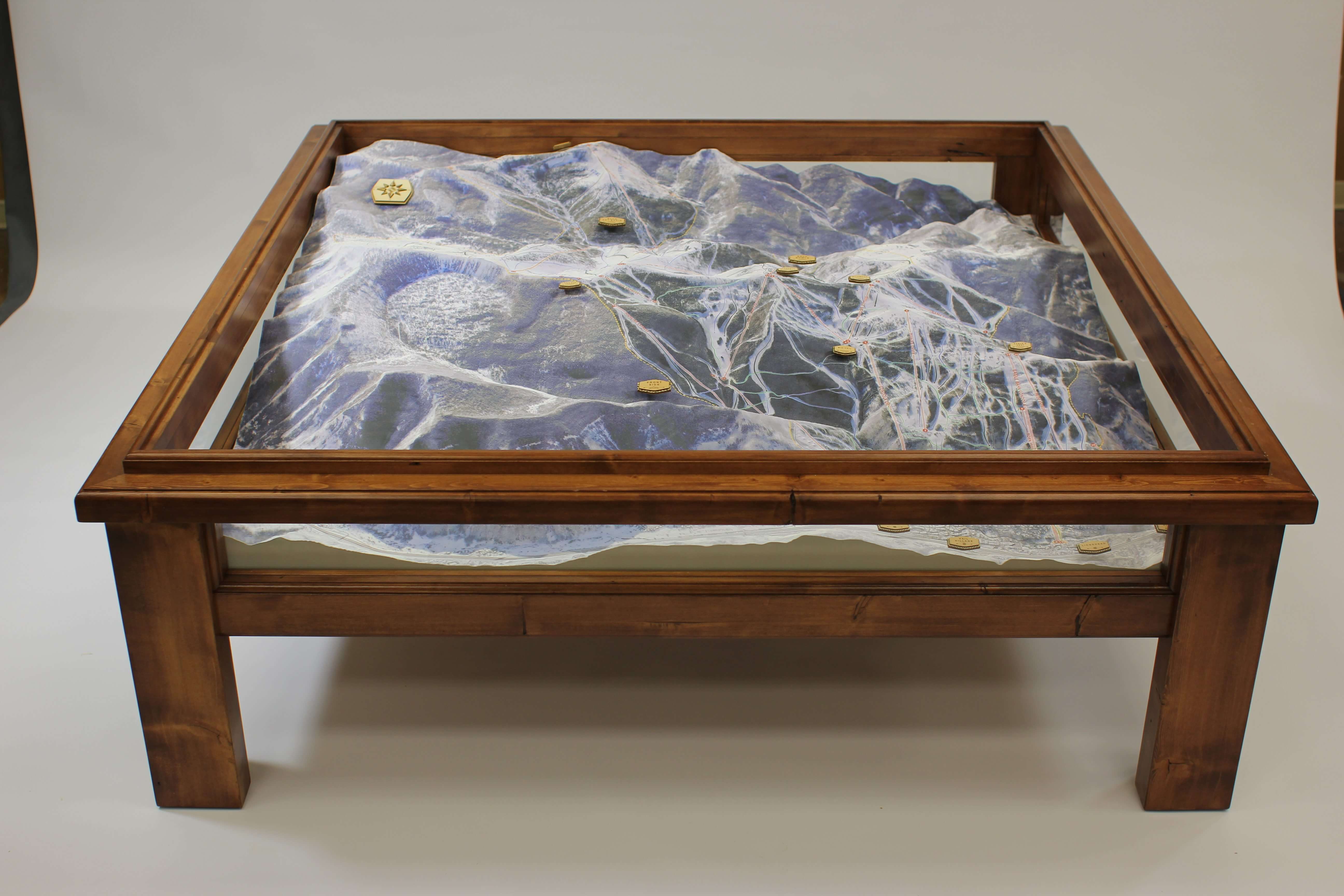

3D Mountain Map Table Display
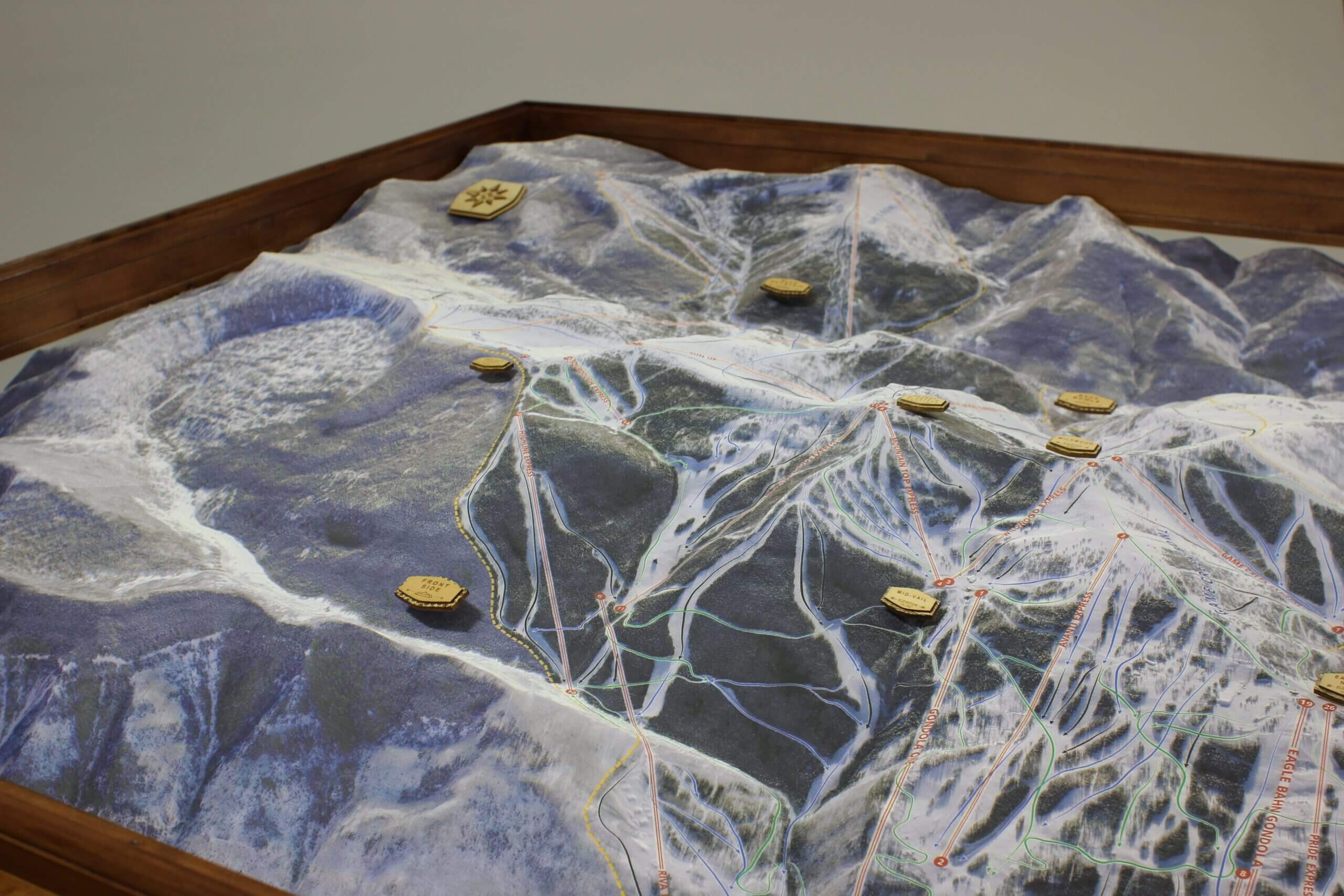
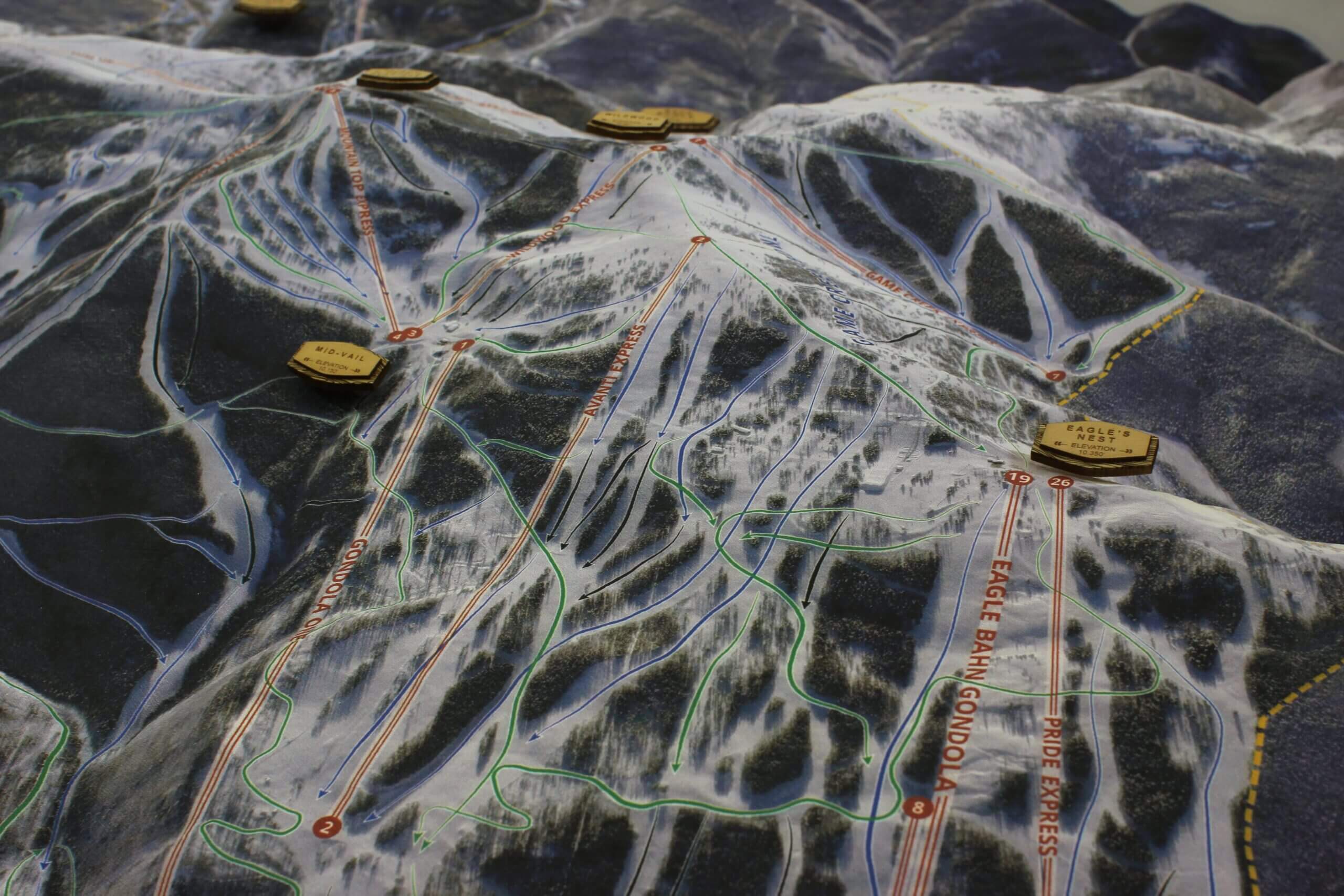
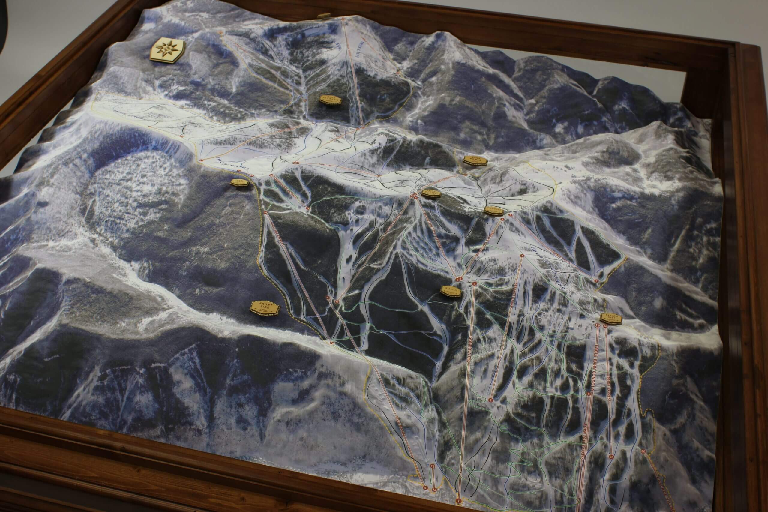
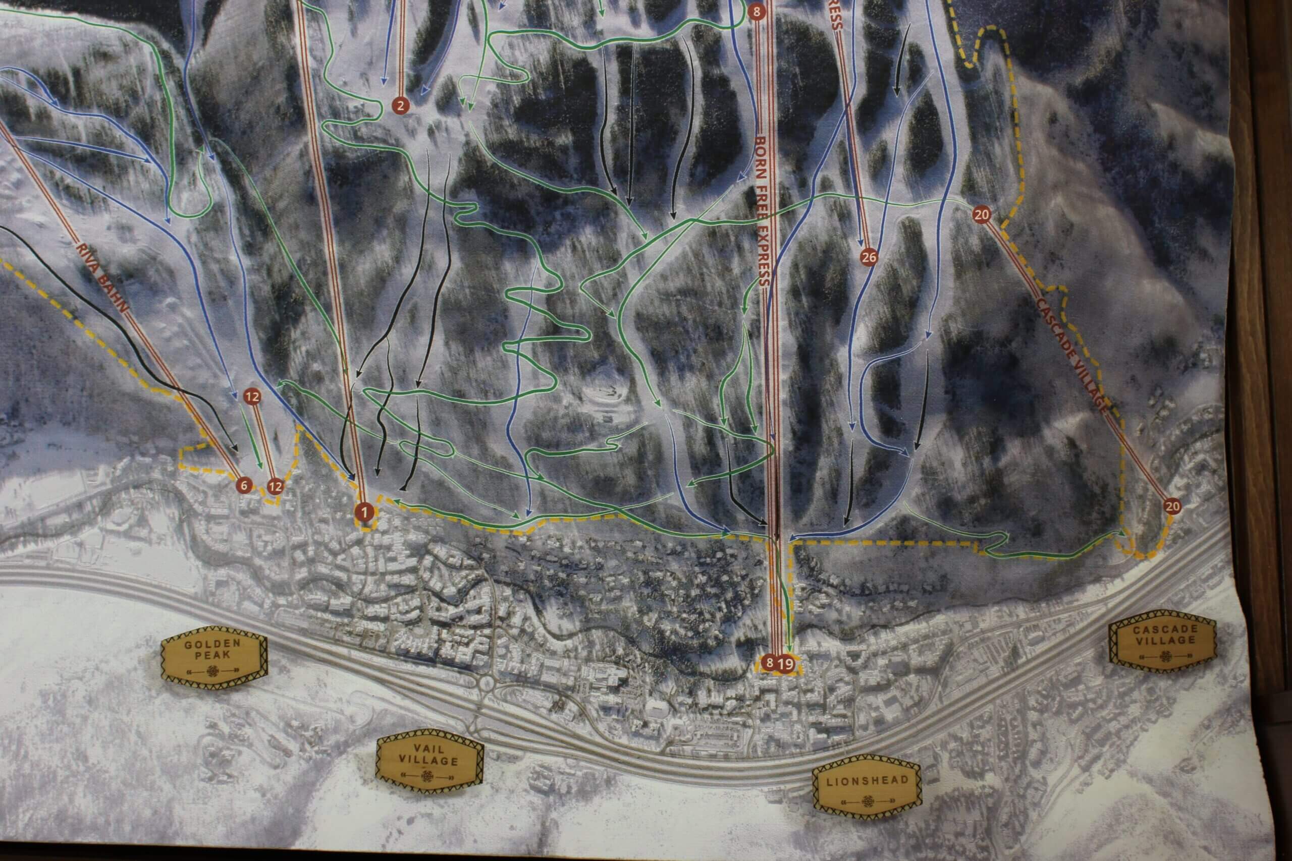
Vail Mountain Ski Trail Map
A private client was looking for a bespoke center piece to have in their living room that enhanced their love of skiing and understanding of the terrain. Vail Mountain is a dense tapestry of ski runs and back bowls, so it was clear that the map needed to have three dimensionality. The family wanted to gather around this at the end of a ski day, so we had the opportunity to play with size and scale.
LGM captured USGS data for the 3D digital elevation topography data, tasked the Airbus Pleiades 1 satellite for the high resolution image, incorporated a flying-head inkjet printer to apply the image, and partnered with a local craftsmen to build the table from reclaimed lumber.
“(We) are thrilled with what Charles and the LGM crew created for us. It’s beautiful and unique.” – Private Client | Vail, CO
Client: Private Client
Duration: 6 weeks
Cost Estimate: $ 25,000+
Size: 48×48″
Scale: 1″=650′
Inputs: Custom Tasked Satellite Imagery, Digital Elevation Modeling and topography retrieval
Equipment & Processes: CNC Mill, Hand Assemble, Painted Finish
In the News: More information about our process can be found in our Lab here.